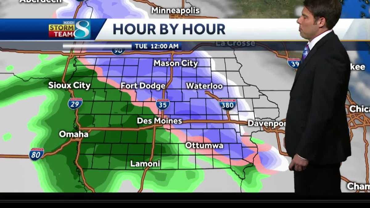
Understanding A Developing Rain And Snow Mix

Table of Contents
Atmospheric Conditions for a Rain and Snow Mix
A rain and snow mix requires a very specific atmospheric profile, a delicate balance between warm and cold air. The key lies in the temperature gradient within the atmosphere—a layer of relatively warm air aloft above a colder layer near the surface. This is often referred to as a temperature inversion.
-
The role of altitude and temperature inversion: As precipitation falls from higher altitudes, it initially encounters the warmer air layer. If this layer is warm enough, the precipitation remains liquid (rain). However, as it descends into the colder air near the surface, the temperature can drop below freezing, leading to a transition from rain to other forms of precipitation like freezing rain, sleet, or snow, depending on the temperature profile and the length of time the precipitation spends in each layer.
-
The impact of moisture content in the air: Sufficient moisture is essential for any precipitation to form. High moisture content in the warm air aloft provides ample water vapor for the formation of raindrops. The amount of moisture will also influence the intensity and duration of the rain and snow mix.
-
How different air masses interact to create this mixed precipitation: The collision and interaction of different air masses—for example, a warm, moist air mass colliding with a cold, dry air mass—are crucial in creating the unstable atmospheric conditions necessary for a rain and snow mix. The boundary between these air masses, known as a front, plays a significant role in the development and movement of this mixed precipitation.
Identifying the Types of Precipitation in a Rain and Snow Mix
A rain and snow mix isn't simply rain and snow falling simultaneously; it can involve several types of precipitation occurring together or in rapid succession. Understanding these differences is key to assessing the associated dangers.
-
Rain: Liquid water falling from the atmosphere.
-
Freezing rain: Rain that freezes upon contact with surfaces that are below freezing, forming a coating of clear ice. This is extremely hazardous as it's difficult to see and causes treacherous road conditions.
-
Sleet: Small, icy pellets formed when raindrops freeze completely before reaching the ground. Sleet is less hazardous than freezing rain because the icy pellets bounce off surfaces, but they still pose a threat to visibility and can accumulate to cause problems.
-
Snow: Precipitation in the form of ice crystals. Snow in a rain and snow mix often falls alongside other precipitation types.
[Insert images here showing examples of rain, freezing rain, sleet, and snow.] It's important to visually distinguish between these precipitation types to assess the potential hazards. Freezing rain, in particular, is often difficult to see until it has already accumulated and created dangerous icy conditions.
The Dangers of a Rain and Snow Mix
A rain and snow mix poses several significant dangers:
-
Icy roads and reduced visibility: Freezing rain and sleet create extremely hazardous driving conditions. Ice reduces traction, increasing the risk of skidding and accidents. Visibility can also be severely impaired by falling precipitation and blowing snow.
-
Power outages due to ice accumulation: The weight of ice accumulating on power lines can cause them to snap, leading to widespread power outages.
-
Increased risk of accidents: The combination of slippery roads and reduced visibility dramatically increases the risk of traffic accidents, injuries, and property damage.
-
Recommendations for safe driving and outdoor activities during a rain and snow mix: Avoid unnecessary travel during a rain and snow mix. If you must travel, drive slowly, increase your following distance, and ensure your vehicle is equipped with winter tires. For outdoor activities, dress warmly in layers and be mindful of potential falls on icy surfaces.
Forecasting a Rain and Snow Mix: Challenges and Improvements
Accurately predicting a rain and snow mix is notoriously difficult for meteorologists. This is because the precise temperature profile of the atmosphere—the difference between the altitude of the freezing level and the surface temperature—is crucial and can be highly localized and change rapidly.
-
Limitations of current forecasting models: Weather models often struggle to accurately capture the fine-scale variations in temperature and moisture that are essential for predicting the type and amount of precipitation.
-
The role of weather radar and satellite imagery: Weather radar and satellite imagery provide valuable data on precipitation type, intensity, and location. However, these technologies still have limitations in precisely determining the exact temperature profile in the atmosphere.
-
Importance of local observations and ground reports: Local observations from weather stations and reports from the public about current conditions significantly enhance the accuracy of forecasts.
-
Future improvements in weather forecasting technology: Advances in high-resolution weather models, improved radar technology, and the incorporation of more detailed surface observations promise to improve the accuracy and lead time of rain and snow mix forecasts.
Conclusion
Understanding a rain and snow mix requires appreciating the complex interplay of atmospheric conditions, resulting in diverse precipitation types and significant safety risks. From the delicate balance of warm and cold air masses creating temperature inversions to the challenges in predicting the exact mix of rain, freezing rain, sleet, and snow, this meteorological event demands attention. The potential for hazardous driving conditions, power outages, and increased accident risks underscores the critical need for preparedness. Stay safe and prepared by understanding the nuances of a rain and snow mix and always check your local weather forecast before venturing out, especially when this type of precipitation is predicted. Refer to your national weather service or reliable weather apps for the most up-to-date information.

Featured Posts
-
 Urgent Hmrc Child Benefit Update Dont Miss Crucial Information
May 20, 2025
 -
 Tampoy I Persa Kai O Ektoras Se T Hermi Antiparathesi Sto Mega
May 20, 2025
 -
 Good Morning America 50 Years Of Excellence Celebrated By The Paley Center
May 20, 2025
 -
 Giakoymakis Iroiki Prokrisi Gia Tin Kroyz Azoyl Ston Teliko
May 20, 2025
 -
 Ereynontas To Tampoy Apokalyptika Stoixeia Gia Mi Eksigimenoys Fonoys
May 20, 2025
