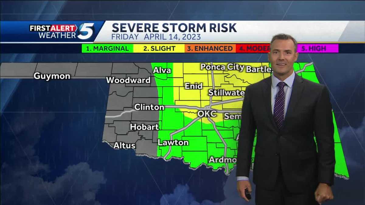
Wednesday Storm Outlook: Oklahoma Hail And Strong Wind Timeline

Table of Contents
Severe Weather Threat Timeline for Oklahoma (Wednesday)
This timeline provides an overview of the expected severe weather progression across Oklahoma on Wednesday. Remember, these are forecasts, and conditions can change rapidly. Stay updated with the National Weather Service (NWS) for the most current information.
-
Morning (6 AM - 12 PM): Scattered showers and thunderstorms are possible, primarily affecting western Oklahoma. While severe weather is less likely during this period, gusty winds up to 40 mph are possible. Monitor radar closely.
-
Afternoon (12 PM - 6 PM): The risk of severe thunderstorms significantly increases across central and eastern Oklahoma. This is the period of highest concern. Significant hail, ranging in size from pea-sized to golf ball-sized or larger, is a major threat. Damaging wind gusts exceeding 60 mph are also highly probable. Areas along and east of I-35 are predicted to experience the most intense impacts.
-
Evening (6 PM - 12 AM): The storm system is expected to weaken gradually, but lingering showers and thunderstorms are possible in parts of eastern Oklahoma. The threat of severe hail and damaging winds diminishes considerably during this period, but remain vigilant.
Understanding the Hail Threat in Oklahoma
Hail forms within powerful thunderstorms when strong updrafts carry raindrops high into the atmosphere where they freeze. These frozen raindrops then fall back down, accumulating layers of ice as they are repeatedly lifted and dropped within the storm.
-
Hail Size Prediction: The Wednesday storm has the potential to produce hail ranging from pea-sized to golf ball-sized or even larger in severe areas. Larger hail is more likely within the central and eastern portions of the state during the peak afternoon hours.
-
Damage Potential: Hail can cause significant damage. Smaller hail (pea-sized to quarter-sized) can bruise fruit and damage delicate plants. Larger hail (golf ball-sized and larger) can severely dent vehicles, shatter windows, and damage roofs and siding. Agricultural losses can be substantial.
-
Safety Measures: To protect your property and yourself from hail damage:
- Move vehicles into garages or covered areas.
- Protect vulnerable plants by covering them with sheets or tarps.
- Stay indoors during the most severe parts of the storm.
Damaging Winds: Expected Speeds and Impacts
Strong winds accompanying the Wednesday storm will result from intense pressure gradients within the thunderstorm system. These powerful downdrafts can create damaging wind gusts capable of causing widespread destruction.
-
Wind Speed Prediction: Wind gusts of 60 to 70 mph are possible in the most severely impacted areas of central and eastern Oklahoma, especially during the afternoon hours.
-
Impact Areas: Areas along and east of I-35 face the highest risk of experiencing the strongest wind gusts. This includes Oklahoma City and surrounding areas.
-
Safety Precautions: To minimize the risk of injury or property damage from high winds:
- Secure loose outdoor objects such as patio furniture, trash cans, and garden decorations.
- Stay away from windows during the strongest gusts.
- Avoid driving during the height of the storm unless absolutely necessary.
Staying Safe During the Wednesday Storm
Preparation is key to staying safe during severe weather. Follow these steps before, during, and after the storm:
-
Before the Storm:
- Prepare an emergency kit including water, non-perishable food, flashlights, batteries, a first-aid kit, and a NOAA weather radio.
- Charge all electronic devices.
- Secure loose outdoor items that could become airborne.
-
During the Storm:
- Stay indoors in a sturdy building. If outdoors, seek immediate shelter.
- Avoid contact with water and flooded areas.
- Stay informed about weather warnings through the NWS and local news.
-
After the Storm:
- Check for any damage to your property.
- Report power outages to your utility company.
- Avoid damaged areas until they are deemed safe.
Conclusion: Preparing for the Wednesday Storm Outlook in Oklahoma
Wednesday's storm presents a significant threat to Oklahoma, with the potential for large hail and damaging winds. The timeline provided offers a critical framework for understanding the expected progression of this severe weather event. Remember, preparedness is essential. By taking the safety precautions outlined above, you can significantly reduce your risk. Stay safe and informed about the Wednesday storm outlook in Oklahoma. Continue checking for updates on the National Weather Service website and local news for the latest Oklahoma hail and wind warnings and other crucial Oklahoma Wednesday storm updates.

Featured Posts
-
 Analyzing The Ashton Jeanty Trade Will It Boost The Chiefs Run Game
Apr 25, 2025
 -
 La Fires Rising Rent Prices And Allegations Of Exploitation
Apr 25, 2025
 -
 Report Ashton Jeanty Set For Meeting With Bears At Nfl Scouting Combine
Apr 25, 2025
 -
 College Students Scramble To Delete Op Eds Amid Trump Visa Fears
Apr 25, 2025
 -
 Renault Confirms 2023 Outlook Despite Chip Shortages
Apr 25, 2025
